
Chapter 2
The storm
On the night of 27 October, the winds begin.
Slowly at first, rainbands sweeping across the southwest, power flickering in Saint Elizabeth and Manchester. By midnight, it is clear that what is coming will be unlike anything Jamaica has faced in living memory.
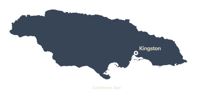
00:00
The rainbands arrive
Winds and rain sweep across south-western Jamaica. First reports of power flickers in St. Elizabeth and Manchester.
01:00
Shelters fill
Residents evacuate low-lying areas. Emergency shelters begin filling across vulnerable parishes.
02:00
The coast is hit
Sustained tropical-storm-force winds reach the coastline. Coastal flooding begins.
03:00
The hills give way
Landslides start in saturated hilly terrain. Emergency services report difficulty reaching rural communities.
04:00
The lights go out
Wind gusts increase dramatically. First major power outages reported across Clarendon and Manchester.
05:00
The water rise
Storm surge begins pushing inland along the south-west coast. Roads near Rocky Point and New Hope start to flood.
06:00
The last warning
Government issues final pre-landfall warnings. Communications begin to degrade across several parishes.
"Things are getting really bad. The wind is getting worse, the rain is coming down in currents, and we now await until it makes landfall." Gillian Scott in St. Catherine
07:00
Hurricane force
Hurricane-force winds begin reaching the coast. Boulders and debris fall onto major roads.
08:00
Roofs lost
Widespread flooding hits south-western Jamaica. Roofs begin tearing off buildings.
09:00
The eyewall approaches
Melissa's eyewall closes in on land. Structural damage accelerates. Trees are uprooted.
10:00
Storm surge peaks
Surge reaches 9 to 13 feet in some areas. Emergency responders suspend operations. Conditions are too dangerous.
11:00
Silence
Near-total power loss across multiple parishes. Communications are severely disrupted. Jamaica goes dark.
12:00
Melissa makes landfall
Category 5. 298 kilometers per hour winds. New Hope, western Jamaica. Catastrophic damage begins immediately.
13:00
The eyewall hits
South-western Jamaica takes the full force of the storm. Roofs ripped off, trees snapped, entire streets submerged.
14:00
Cut off
Landslides intensify. Major roads become impassable. Entire communities are cut off from emergency services.
15:00
Flash floods
Peak rainfall drives flash flooding across the island. Hospitals and schools sustain significant damage.
16:00
Moving inland
The eye moves into central Jamaica. Manchester and Clarendon face extreme winds and flooding.
17:00
The north is hit
Northern parishes begin to feel hurricane-force winds. Forests on steep terrain suffer catastrophic damage.
18:00
Still dangerous
The storm weakens slightly but remains extremely destructive. Watersheds destabilize, increasing landslide risk.
19:00
Isolated
Floodwaters continue rising. Entire communities are unreachable. Emergency shelters reach capacity.
20:00
A slow retreat
Winds begin to subside in the south-west—but remain destructive across the rest of the island.
21:00
Moving on
Melissa tracks north-west, exiting Jamaica's northern coastline. Heavy rain persists.
22:00
First look
Initial assessments begin in accessible areas. Officials describe the damage as unprecedented.
23:00
Search and rescue
Teams mobilize where conditions allow. The scale of what they find is overwhelming.
24:00
Darkness
Jamaica is left without power across western, central and northern parishes. More than 1.5 million people are affected. Between 45 and 102 lives are lost.
As the storm passes, UNDP teams are already on the ground, thanks to strong partnerships with national authorities and local communities, and core funding from donors. Without delay, the focus shifts from preparation into early recovery. Sources: Unicef, UN News, Jamaica Observer, TravelPulse
28 oct.
2025
Winds: 185 km/h
Cat 4.
The long night begins
00:00 - 06:00
Approach to landfall
07:00 - 11:00
Landfall and peak destruction
12:00 - 15:00
Passage across the island
16:00 - 20:00
After dark, the storm exits
21:00 - 24:00